How to create interactive maps with MapHub
This free mapping tool allows you to easily illustrate and draw routes between points of interest


This free mapping tool allows you to easily illustrate and draw routes between points of interest

This article was migrated from an old version of our website in 2025. As a result, it might have some low-quality images or non-functioning links - if there's any issues you'd like to see fixed, get in touch with us at info@journalism.co.uk.
Maps may not be every graphics editor or reporter's favourite way to illustrate information, particularly a more interesting dataset that can lend itself to a more creative format, but sometimes they are the best way to take your readers from point A to point B – literally.
We have written about mapping tools before, so make sure you check out the list (and stay tuned for an update!), but in the meantime this guide will show you how to create a quick interactive map using free platform MapHub, which is currently available in beta.
Creating an interactive map with MapHub
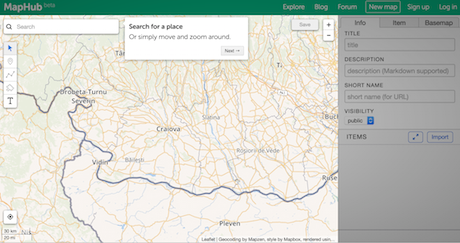
1 – Go to https://maphub.net/map.You will see a map showing your current location. Move around or use the search bar at the top to find a specific place.
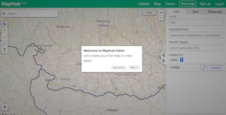
For the purpose of this how to, I will create a map showing the locations of three London newspaper buildings.
When searching, I found the tool gives better results if you look for the name of the street, rather than the postcode or the exact name of the building such as 'News UK' or 'The Economist'.
2 – You can also import your own existing data in a KML/KMZ, GPX or GeoJSON format by clicking the 'import' button on the right side and uploading the document from your computer.
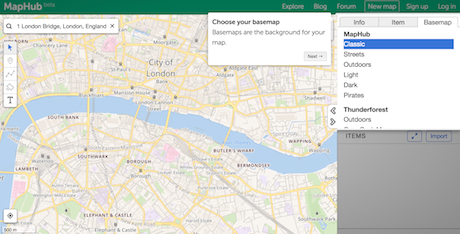
3 – Next, choose the background of your map from a list of options that include MapHub's own six layouts, and a list of others from Thunderforest, MapQuest and CartoDB for example. I chose the Outdoors background.
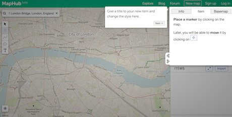
4 – The menu on the left side has five buttons that will allow you to add multiple pins or points of interest, insert text labels to highlight important information on the map or draw routes between your locations using the polygon tool.
Use the second button in the list, called 'Point', to place your first marker on the map, like I did with 1 London Bridge, and give it a name. You can also change the pin's colour and set an icon to illustrate what it is, such as a building.
MapHub also lets you add more text in the description box that will be displayed in a pop-up window above your landmark, which you can use to provide any relevant information about the place or external links.
5 – Tip: Searching for the name of the street as in the above example will not take you to that specific location, but rather show you the general surrounding area of it on a map. To pinpoint it exactly, you can input the longitude and latitude into the boxes provided on the right.
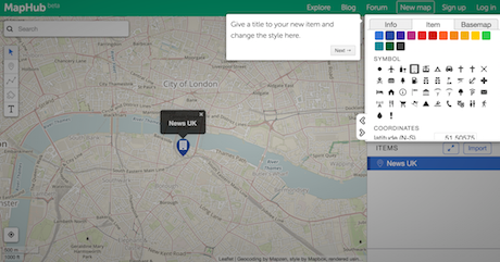
These coordinates are easy to get from Google Maps – search for the address, right click on the pin, select 'what's here' and they will come up in a box at the bottom of the screen. Copy and paste them into MapHub and your pin will automatically move.
It does take a bit more time but I was not able to achieve the same result from within MapHub, which is why I decided to get them from Google Maps.
6 – Go ahead and add a few more pins to your map – I have settled on three: News UK, The Economist and Daily Mirror.
7 – Now that you have a few locations in place, you can track a route between them. Click on the third button from the left-hand menu indicating the polygon.
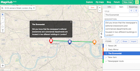
Zoom out to see all your points clearly and with the polygon tool selected, subsequently click on each marker and then select the starting point again to signal the route has ended, or press the Esc or Enter button on your keyboard.
8 – You can always retrace your route, delete it and start again or move your pins on the map. Once you're happy with the result, hit 'save'.
Your map can be private or public, but you will need to register for a free MapHub account to save and export your map (it only takes a few seconds).
9 – The 'share' button next to 'import' will let you download your map in a KML, GPX, GeoJSON or JPG format, as well as get a custom link to it and generate an embed code for your website.
Are there any other mapping tools you have used and found useful? Let us know on Twitter at [@journalismnews](https://twitter.com/journalismnews).